![]()
According to many the famous picture of an alleged BUK launch plume is key-evidence regarding the guilt of the Donbass separatists in shooting down flight MH17. But two German engineers show with simple and straightforward calculations actually this plume consists of two totally unrelated trails.
In the Infowar that started within moments after the crash of flight MH17, which cost the lives of 298 people, the Ukrainians dealt the first blow. Within hours they disseminated intercepted phonecalls with ¨confessions¨ and images of the alleged murderweapon on its route to the alleged crimescene. It was a trail of evidence showing an obvious suspect, an clearly identified weapon and a more or less fixed site of action, ready to be picked up by every media outlet that wanted to blame the right side.
Focal point of this trail implying the Donbass separatists became a site south of Snizhne, a spot in area they controlled and from where they allegedly would have launched a BUK surface-to-air missile. That they really had fired such missile became evident when three hours after the crash in a tweet a picture surfaced of a plume appearing to be a BUK launch trail. As it is the only evidence of such a launch it is poised to get a star role in a possible criminal case some states are eager to instate.
Now the drums of war make their pounding sounds throughout the international realm and pro-Kiev forces are pushing for a trial to hang the Donbass Separatists and their Russian helpers for downing MH17, a few dissident diehards are challenging this western, pro-Kiev perspective on the evidence of an already established launchsite. And they seem to succeed.
Spreading the blame game
Pro-Kiev infowarrior @WowihaY, alias of Vladimir Djukov, issued the now famous ¨plume pic¨ in a tweet at 19:23 local time, 3 hours after the crash.
свидетель скинул фотку момента пуска ракеты.На горизонте канатная дорога между Лутугина и Цоф #Торез граница #Снежное http://t.co/Z3mBtLjWfa—
Хуевый Торез (@WowihaY) July 17, 2014
An hour and 22 minutes later the news seemed to be picked up already by the advisor for the Ministry of the Interior, Anton Gerashchenko. Remarkable feature of his posting was the swift spill-over from the @WowihaY tweet, but also the inside information that was conveyed about where the photo was taken from:
¨Putin! You and your cronies can not get away from the international tribunal!
This photo contrail left as you launch missiles SAM “Buk”.
It made a few minutes after the rocket launch of Microrayon 3 Torez city from west to east.
Thousands of people saw the launch and flight of the missile, which you kindly gave to the sponsored terrorists!¨

Ukrainian official Anton Gerashchenko posted the plume, together with a threat addressed to Putin, not long after @WowihaY posted the first plume picture.
It was obvious there had been immediate contact between @Wowihay and Gerashchenko. Probably the information made public served to spur @WowihaY himself and other infowarriors to ¨geolocate¨ the origin of the plume on the picture. Djukov reached his result at night and helped another, more famous infowarrior, renowned blogger Ukraine-at-war, to spread the news over the net. The blog Ukraine-at-war posted on July the 21st with a final geolocation of the plume was done in full cooperation with Gerashchenko contact @WowihaY and served from that moment on as the well established proof of guilt of the Donbass separatists.
After that, in December 2014, Dutch commercial TV channel RTL4 issued an
interview with the maker of the photo, Torez citizen and ex-military for the Ukrainian army @rescuero, alias of Pavel Aleynikov. Furthermore RTL deployed experts to verify the veracity of the launch plume picture. These experts didn´t fail to deliver what was asked. According to them they couldn´t find evidence the picture of the plume was tampered with.
Bellingcat takes over
Apparently this was enough back-up for pro-NATO investigating team Bellingcat, from the first moments after the crash involved in perfecting the case against the anti-Kiev rebels, to take the pole position in the infowar spinning around the plume photo. They stepped in and issued a report, written by Daniel Romein, on Januari the 27th, 2015, to corroborate a south of Snizhne launchsite, as Daily Telegraph journalist Roland Oliphant (in situ) and Ukraine-at-war (from behind his desk) also had appointed within days after the crash. Besides, they established the timestamps of the originals they allegedly received from the photographer and verified the plume pic was genuine.
Criticism that the weather on the plume picture (rather sunny) didn´t seem to correspond with the actual weather situation (cloudy) was smoothed over by issuing a second photo. The photographer apparently had taken a picture of the plume 7 seconds before the famous one, showing cables in the front because his camera allegedly had autofocused on them. This photo with a wide panaroma over the area showed clouds.

Aleynikov´s ¨Photo 1¨, his picture of the plume with cables in front, issued by Bellingcat to tackle the weather issue.
Another remarkable insight the Bellingcat report provided was that the plume, which existed of a part of dark grey smoke touching ground level and a part of a vertically swirling white plume, was scientifically confirmed to be comprising traces of an early stage BUK launch plume. The grey part would account for that, according to Romein:
¨Even the cloud of grey smoke characteristic of the first stage of a Buk missile launch can be seen in the 17 July 2014 pictures.¨
As this grey smoke touched the ground, it was easy to geolocate the exact spot from where the missile had being fired and corroborate earlier findings. This report no doubt contributed much to the faith the pro-NATO side in this infowar had in the launch plume and the launch site it entailed.
But in reality almost every feature of the report was contested and seemed to display serious fallacies. The timeline that could be deduced from the statements of the photographer and the metadata of his photos didn´t add up; the 7 second interval between the picture with cables and the zoomed picture without was questionable; the exact spot from where the photographer had taken his photos (balcony or roof) had to be revised; and the features of the photo itself (odd vignetting, digital alterations, added noise) showed the Bellingcat ¨originals¨ weren´t originals at all [1].
Finally, the characteristics of the plume itself lead people to contest the veracity of the plume pictures up til the level of very serious doubt if not debunk.
Taking on the smoke
Daniel Romein made a case claiming the dark grey smoke resulted from the initial stage of the firing and the white trail from the missile propulsion along the way. The strange curve the trail made would have been due to the specific features of the wind and weather at the launch site.
¨We assess, based on the direction of the wind only a few hours earlier, that varying wind speeds at different altitudes caused this sharp turn.¨

Enhanced versions of photo 1 and 2, showing the dark smoke curling up into the white plume. According to Bellingcat this feature showed the first stage exhaust of a BUK launch. The plume from the second pic has been moved back to fit the plume of the first photo. It can be seen the white plume doesn´t change in shape and therefore seems to be immune for wind shear effects.
According to forensic specialist Charles Wood his own investigation showed the Bellingcat analysis reported the wrong wind gradients, impossible meteorological effects and the faulty conclusion the white smoke never could be related to a GRAD missile, heavy used in that area at that time.
The conclusions drawn by Wood were very interesting, to put it mildly. He claimed, based on this investigation, that in fact: ¨[t]he only conclusion is that the dark plume is unrelated to the white plume.¨ The dark grey/black smoke could not have been ¨from the rocket 1st stage exhaust¨, as claimed by Romein, because a BUK launch shows mainly dust from the backblast.
In fact the Bellingcat report showed an image with 4 BUK launches, but supported with it the claim there are back blasts of dust to be seen.
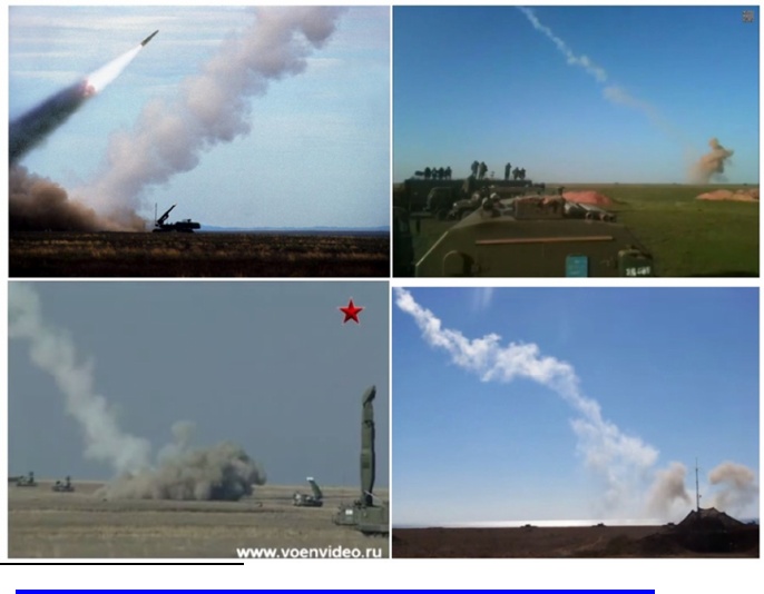
In fact the Bellingcat report showed an image with 4 BUK launches, but supported with it the claim there are back blasts of dust to be seen.
Another researcher, Michael Kobs, reached the same conclusions in his elaborate report ¨The Bellingcat Launch site¨ (see p. 80). Like Wood he concluded the black smoke and the white trail could not be related and like Wood he detected from the two plume pics a ¨lack of lateral dispersion¨, as he wrote to me:
¨When we compare the two pictures taken 7 seconds apart, the contrail seems to move without shear deformation. That means the photos display the same wind speed up to 1000m elevation, which is not likely. Furthermore there can be detected a change in shape of the black smoke in the 7 seconds between the two photos, whereas the white smoke remains unchanged and is just shifting to the right.¨
Daniel Romein answered in a reply on the Bellingcat website:
¨(…) The claim that the grey smoke and white smoke trail are not connected does not make much sense, since we obviously can see on the image that where the grey smoke ends, the white smoke trail starts.¨
In fact it was this exactly fitting mix of dark and white smoke which triggered critics to question the official Bellingcat endorsed story, for as the shape of this trail could in fact never be found on other images of a BUK launch nor be established with physics. One could see clouds of dust blown up, yes. But black smoke exactly fitting a white missile trail?
Michael Kobs again:
¨The black smoke overlies the contrail to an altitude of about 100 meters. While a missile reaches that altitude in some seconds, the black smoke would just have begun to rise slowly from the ground after being ignited by the same missile. Therefore it is impossible for the black smoke to rise at that altitude within seconds, especially as the lower end of the contrail is still located at ground level.
Smoke rises due to heat! That initial black smoke would be much hotter that the contrail. The ignition itself due to a hot flame wouldn’t generate “cold” sooty black smoke from plants. Only an oxygen lacking, almost smothered fire would generate black smoke. Even if a missile would ignite a large area of a dry field, we would observe a gap between the floating contrail and the later rising black smoke.¨
In fact, not only pictures of launches and this kind of reasoning based on physics let the air out of the Bellingcat launch plume report, also calculations showed there was something very wrong with this two faced missile trail.
Calculating the plume to its real origin
Because Bellingcat issued the second plume pic, the one with the cables, there could be established how fast the plume had travelled in the 7 seconds the pictures were taken apart from each other. Both Ole and Michael Kobs, two German engineers with forensic affinity, estimated the speed of the trail would be more or less 40-42 pixels per 7 seconds.
Estimation of the distance the plume moved in the time between capturing the two pictures of the plume. On the average the white plume travelled about 40-42 pixels between its position on photo 1 and photo 2, taken 7 seconds apart.
Now this was established it would be easy to calculate the origin of the white plume taking this speed into account. The question is in fact how many times the missile trail has to be shifted 40 pixels to the left (against the wind direction) to get in line with the source of the black smoke. That is the same question as: How many 7 second intervals needed the missile trail to drift from the source of the black smoke – which is allegedly its origin – to the place where it is on the Aleynikov photos.
It can be estimated these were about 11 intervals, meaning the white smoke had moved about 11 * 40 pixels from its alleged origin (that is to the red line in the image above). So, in other words, the plume had travelled from the firing at about 11 intervals of 7 seconds because of wind drift, which amounted to about, say, 80 seconds. Then, according to this calculation, the first plume picture could not have been taken after about 16:20:50 local time, for as the time of missile impact was 16:20:03 (when the Flight Data Recorder stopped writing) and the launch of the missile from the alleged site consumed about 33 seconds. If the missile was launched at 16:19:30 and 80 seconds are added, then the above absolute maximum time of capture has been established.
This was a miraculous result. Because the main fuselage of the plane and the tanks fell on the ground near Grabovo at about minute 16:22 assuming 2-3 minutes descent time, and the crash had alarmed the photographer to take action, these pictures must have been taken well before the crash. Obviously, at its best this was not very likely as it went against the law of causality.
The trail that wasn´t a launch plume
Though Bellingcat had stumbled time and time again over the implicit timeline emanating from their assumptions, finally they reached a conclusion. One of the administrators of webtalk.ru, a Russian disussion forum, showed with a ingenious method based on shadow-casting analysis the time of the first Aleynikov picture should be set at about 16:22:40. Bellingcat endorsed this time, because:
¨(…) this exercise in tandem with the self-reported EXIF data demonstrates that the launch photograph was indeed taken soon after 4:20pm, the time of the MH17 downing.¨
In fact they dug the grave of the plume much deeper with this, because now could be established where the plume really started at the moment of the launch, taken into account the method used in the paragraph before.
But first a new comparison could be made. Aleynikov should have photographed the plume – according to the time lapsed between his two pics and their metadata – before 16:20:50. So the plume would have been 1:50 minutes delayed if now a time of 16:22:40 should be reconsidered. That is, the plume must have hold itself steady against the wind drift. It had drifted, of course. This could be seen on the two photos. But apparently with much resistance against mother nature. Maybe it has to be reiterated once more, but of course there is no question about the fact this is a really strange irregularity.
According to Ole Bellingcat had made a mistake. Obviously…
¨Bellingcat has a strange understanding of how the smoke trail is moving together with the atmosphere it is embedded in. Actually the smoke trail will be embedded into the atmosphere in a very small time interval i.e. almost instantaneously. Once it is embedded then the smoke trail moves as a whole together with the atmosphere.¨
Then, as said above, the real period of time the wind had drifted could be established. Maybe Bellingcat already felt they made a huge mistake by endorsing the new timestamp, because a comment made by Michael Kobs never reached the website. So he made the comment on my blogsite, with a short calculation added:
¨The funny part of it: Bellingcat debunked their own launch spot without noticing and, of course, my comment wasn’t allowed by the administrators. However, the time 4:22:40pm means the image was taken about 160 seconds after the last written FDR data. Let’s add 30 seconds for the flight of the missile. Hence, the image was taken about 190 seconds after the launch.
We know that the Aleynikov contrail moved 41 pixels in 7 seconds to the right in the cable-shot. Therefore we just need to go 190/7 = 27 times 41 pixels – that’s 1107 pixels – to the left of the contrail in the cable shot. Anyone – even Bellingcat – can check it. The rising black smoke is completely out of range.¨
So, recapitulating, 190 seconds is the time between launch and capture of the first plume pic. In 7 seconds the plume travelled 40-42 pixels, as the previous paragraph showed. Those 190 seconds contain 27 intervals of 7 seconds each (or, say, 41 pixels), which amounts to a distance of 1107 pixels. When calculating backwards, so to speak, the plume must have had its origin 1107 pixels to the left from the white trail on the first plume picture.
Later Kobs provided visual back-up to make his statements more clear. The white plume originated from a spot of about half a mile to the east of the spot where the dark smoke touched the ground. So the missile trail really had two faces with each their own origin: a white one and a grey one.
![]()

According to the calculations performed by Michael Kobs, the origin of the white trail would be in the left circle, taken into account a time of 16:22:40 the photograper took his first plume photo. Obviously this site is far more to the left than the alleged origin of the launch, the spot where the black smoke touches ground level.
We know the dark one
In the meantime the probable origin of the dark smoke had become known after Max van der Werff published an article with a photo of black smoke, originating from the same spot Aleynikov had photographed it.
The smoke could be coming from the Lutugina mine at about 4.5 km from Aleynikovs apartment, right in his line of sight on the plume. In fact, Bellingcat had stumbled on it when they tried to geolocate the plume, but never thought it might have been interesting to sort out if it could interfere with the trail. Another source of the smoke could be the Voskresenskaya mine (https://www.google.lt/maps/place/48%C2%B000’48.0%22N+38%C2%B041’36.0%22E/@48.0133333,38.6933333,657m/data=!3m1!1e3!4m2!3m1!1s0x0:0x0) located at about 5,5 kilometers from the photographers point of view. Looking for photos of this Voskresenskaya coal mine one may find this webpage. It shows real Aleynikov originals.
So there is some kind of certainty where the black smoke came from. But what then was that white vertically swirling plume Aleynikov had managed to position exactly on the top of that black smoke?
It´s a question nobody but the person(s) involved could answer at this moment. Nevertheless for now it suffices to say this key evidence has been blown up by so many irregularities it will be hard to hold on too.
The white trail seemed to show no apparent change in shape after a 7 second interval in which wind shear would have worked on it. The ultimate time the picture should have been taken according to the wind drift didn´t add up with the known basics from the timeline. And, foremost, the plume consisted of a mix of two perfectly fitting trails of smoke that could not have had any relation with each other. And there are more features of these pictures that can be contested (see the forthcoming report ¨The trail that wasn´t a launch plume: A reconstruction¨)
It will be interesting to see how long this strangely mixed two faced miracle will be held up in a possible trial against the Donbass separatists. If it even reaches the court benches.
With special thanks to Ole, Michael Kobs and Sergey Mastepanov
Note:
[1] For these and other issues concerning this piece of evidence, see the forthcoming report ¨The trail that wasn´t a launch plume: A reconstruction¨

295 people died?
LikeLike
Typo. Changed it. Thanks for mentioning.
LikeLike
Here is a carefully revised version in favor of the alleged launch spot.
Maybe someone out there gets the numbers straight into a conclusive timeline of the events:
https://www.dropbox.com/s/pa7v8o76zsm3mbr/Launch%20spot%20by%20numbers.pdf?dl=0
LikeGeliked door 1 persoon
Buk+Volvo truck image①7.17morning,Donetsk②7.17about noon,Torez③7.18early morning,Luhansk…are each different in the detail.
Please,looking!
Buk side structure①≠②③,Volvo door drawn blueline②≠①③.
LikeLike
You are absolutely right. It is known. I.e. the white stripe between the blue ones on the white truck seems to be missing in the Luhansk vid. Zuhres BUK seems to have no netting? BUK on Paris Match doesn´t fit al kinds of parameters. A forthcoming report about this last one will be published by Michael Kobs, as I understand it (its an extra chapter in English to his German version posted on this blog in ¨The 17 July sightings¨).
LikeLike
One other theory potentially explaining the two faced launch plume: a double launch of Tochka/SS-21 ballistic missiles, with one possibly failing as is proposed here: https://www.youtube.com/watch?v=Ebw2_A5K_SQ if you ignore the Google dating attempt since there are just no usable images between July16-21 from DigitalGlobe’s satellites and Google somewhat muddles the displayed dates.
This should all be falsifiable in terms of location and exact time. Especially a possible launch on July 17th but Tochka launches from that location around that period might be itself important to verify. It could explain some witness statements. And it would explain US picking up a launch and trajectory but not from a BUK (saves one from claiming conspiracy everywhere). And it would explain that this launch would not be on some primary radar because of stealth “cruise missile” mode or just altitude since it’s ballistic, easily > 20km, which might be out of reach.
The BUK missile could then indeed have been Ukrainian defense who programmed the wrong target. Questions would be who fired the Tochka ballistic missile and in which direction and which BUK brigade could have targeted it and failed.
Interestingly that they found a Tochka motor on a field south of Ilovaisk end of summer 2014:
http://edition.cnn.com/2014/09/03/world/europe/ukraine-kill-zone-lister/
If one draws a line between Ilovaisk and the launch plume, one could see it intersects MH17 not that far from suggested detonation point BUK. But there are other scenarios too. Many claims are out there that Tochka was launched a lot during that period but charges are from both sides which makes it difficult. But these missiles would certainly become target for SA-11.
It might sound far fetched at first but main lines of evidence holds as only solution so far, which should be considered for that reason:
1- US tracking of missile launch in the direction of flight M17 (but considering amount of airliners, could have been any intersecting on the map)
2- no primary radar from this launch (vertical launch, high altitude)
3- claims of Russians and militia not having or transported “BUK”
4- JIT verified a photo of vertical launch plume and darker smoke with space in between (the failed launch setting field on fire)
5- some witness statements on the launch sound + plume could be correct
6- BUK scenario of missile hitting MH-17 can still remain overall
This theory should be examined further because if it’s true, many very tragic mistakes are being made right now, conclusions based on tricky evidence which for political reasons will not be examined anymore further. Denying the mainstream explanation is one thing, coming up with a believable alternative is a whole another thing…
LikeLike
Thanks for your reply and elaborations, Herman. I will share it.
LikeLike
Great, thanks Hector. The referenced launch video is a clip one can find starting to pop up mid April 2015 eg https://www.youtube.com/watch?v=gt5g898yhos but various commenters aer suggesting it was most likely from summer 2014. Lots of discussion: http://www.liveleak.com/view?i=bd1_1429332990
Most seem to suggest it’s pro-Russian militiamen launching but one could easily imagine the other way around. The core issue here is the use of ballistic missiles during July and August 2014 in the first place. It’s strange these are not discussed front and center, considering all the implications. The role of Buk defenses, the issue of closing airspace, the question of who was delivering or maintaining them, all are interesting in terms of how it’s *not* being discussed at all that I could find. Or at least I cannot find much about it beyond the usual claims and accusations. While you’d expect it to be much more part of the MH17 analysis on the air war, air defenses, missile detection, transports and Russia bashing in general. And yet, I draw a blank. The most bizarre scenario being that one pro-Kiev militia launched the SS-21 and some other army unit tried to take it out. And all would keep quiet?
LikeLike
Its pretty difficult to investigate. Short scan reveals Ukrainian Tochkas deployed around 29 july around Saur Mogila:
https://www.rt.com/news/176484-cnn-ballistic-missiles-ukraine/
UAF brought other ADMSs with them on 16 july, according to separatist sources: “10:20 (MSK) – Battles began again in the area of Saur-Mogila. Ukies are pulling together their last reserves – they are transporting Smerch, Uragan and self-propelled howitzer units from Shepetovka.”
http://vineyardsaker.blogspot.nl/2014/07/igor-strelkov-and-militia-briefings_17.html
LikeLike
Thanks for the links. Hard to find good specifications on this aging system but clearly it has two flight modes: ballistic or cruise. There is direct guidance possible and it might include some simple anti-radar measures. This opens even the door to some of the reported “jet” sightings and explosive sound barriers pop if this baby flew over. Any Ukrainian BUK crew further on would have to decide quite fast which target to select. It would even need several launches to make sure. This might also mean it’s very possible the BUK crew thought they took down the SA-21 that day (likely no recordings of their targeting). And neither side can ever admit firing any of these weapons, of course, so now attempts are made to blame each other with all the geopolitical chess involved (“forcing moves”).
It’s still a theory but further geolocation is in progress and a better dating of the video. Then it can be put to rest but It would help if the US would reveal the nature of their observations on the 17th and how they have identified the heat signature through SBIRS Low. Instead we have to listen to telephone taps!
LikeLike
Official sources mention Tochka use by UAF from 28 july:
http://forum.khabara.ru/topic_13037
http://petrimazepa.com/goddot.html
According to “Andrew”, who drew up a very elaborated report about the military positions in Zaroshchenskoye area Russia reportedly shot down Tochka-U’s fired by Ukraine at Donetsk around July 21 with S-300 systems.
LikeLike
Micha Kobs did some geolocation efforts:
LikeLike
Good! At first glance, considering the varying landscape features, sloping down but sometimes up again, “disappearing” low trees or shrubs beyond hundreds of meters would not be that unusual. And the shadow behind the photographer is to me obviously not much like a tree but a construct, tent or vehicle. In other words, it doesn’t seem falsified very convincingly yet while it’s the only theory I’ve seen so far with some presented evidence which could explain the key pieces of JIT evidence without involving any Russian BUK driving through social media land.
Herman Aven
LikeLike
Micha Kobs wrote the following to me about the Tochka scenario
“Some reports confirm the CNN/NATO version of Tochkas used. But there are some problems with the Tochka launch plot.
1) every Totchka launcher carries only one missile. There is only one launcher in the video. Therefore the first explosion isn’t a failed launch since the only one missile was launched just seconds later. So what is it. Some kind of flares?
2) the sky is bright blue while the sun appears to be low (late afternoon or evening);
3) the smoke from the first explosion is almost white and cannot explain the dark black smoke in the Aleinikov image;
4) the geolocation is wrong but the author of the video tries hard to ignore it
– the line of trees (~10m high) along the street are missing in video but would block the sight to the east
– the poles in the video are at almost the same distance to each other but the “located” poles would show a very different pattern
– the 3rd pole from the left would be 10km away from camera (compare energy line in Aleinikov images 4.5km away from camera)
– single tree at the north edge of field is missing in the video
– trees along the north side of the burnt field are also about 10m tall > in the videos are just bushes;
5) almost no wind in the Tochka video
The cruise missile type of that missile 9M79MKU was never produced. Russia suspended the developement after a prototype.
There is a ballistic variant that searches for the radars of the enemy. That missile has no active radar to search a target but uses the radar of the enemy to destroy thoses radars.
Imho we can rule out that a Tochka destroyed MH17 but you can use a BUK to destroy a Tochka.
Imho the aligned black smoke cannot be explained by a failed start because
– neither failed start nor burning field produces pitch black (carbon rich / almost no steam) smoke shortly after ignition
– the geometry of a ~45° launch plume and the black smoke in the foreground excludes that both smokes started at the same spot because both colors simply travel with the wind to the west. hence, the black smoke would rise behind the slanted trail
>> only a huge cloud of black smoke (initial radius >200m) or a closer source would appear in the foreground
>> a huge cloud should be seen in the AT tripod video / any different source in the line of sight of Aleinikov should be seen in the Saur Mogila shot
>>>> so either the source of black smoke disappeared just like the trail before the Saur image was taken and/or the black smoke is behind the horizon in the AT tripod image
However, any closer source of the black smoke should appear proportionally faster in the wind!!! …but the black smoke appears a little slower!!!
>> yes, the wind close to the ground is slower but half distance would appear twice as fast moving
>> imho all that was said about the missile trail (the Aleinikov timeline, displacement during 7s, wrong field …) still is sufficient
BUT the arguments are simply ignored because they are not easy enough to influence the masses
A failed Tochka wouldn’t solve the problems. A BUK that tried to shoot down a Tochka (coming from the north?) would explain the launch but if that BUK missed the Tochka we probably would know about some heavy explosion.”
LikeGeliked door 1 persoon
Thanks. As for geolocation and time or date that video can be indeed be now rejected for the claimed field. The other arguments are not convincing as the Tochka often launches in pairs and the dark cloud would be from ignited field around the first failed launch. Ah well, never mind that.
But the Tochka scenario as a whole, not entirely dead yet. Obviously any Tochka scenario would never include hitting the MH17 directly with such weapon. Nobody ever claimed that. It’s also reasonable to assume that minimal two BUK missiles would be launched to any approaching ballistic warhead (who know what Ukraine believed the warhead would contain). Then one SAM hit the airliner. What happened with the other missiles would be speculation . All the Soviet Tochka missiles and warheads are very old and known to fail upon launch or impact.
Or like Siberia Airlines 1812, one missile took out the target drone, the other failed self-destruct and homed into the airliner instead. Why not a similar scenario?
Any other scenario involving something else in the sky under the MH-17 that day would be something like a Tupolev Tu-143, maximum speed 950 km/h, service ceiling 5km, which could be taken the wrong way by witnesses and/or air defenses. http://foxtrotalpha.jalopnik.com/pro-russian-rebels-find-soviet-era-high-speed-spy-drone-1615132206: “A few months ago, Ukraine mentioned that it was refurbishing some of its long-stored TU-141/143 drones”. But that’s another topic perhaps.
Herman
LikeLike